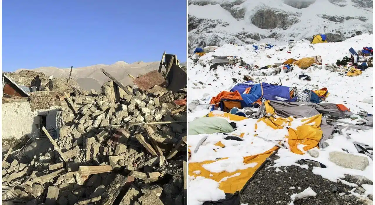
An earthquake of magnitude 7.1 near Mount Everest jolted Tibet, close to the border with Nepal, early this morning, killing 95 people, Chinese news agency Xinhua said via AFP. Tremors were felt as far as Bihar, Assam, and West Bengal in India, causing panic but no immediate report of damage.
Epicenter and Impact of Earthquake Near Mount Everest
A tremor has shaken Tingri County in Shigatse City, 400 km southwest of the Tibetan capital city Lhasa. The county is near the Nepal border, serving as an entrance to Mount Everest, the world’s tallest peak. The National Centre for Seismology reportedly felt the earthquake at 6:35 a.m.
Two aftershocks followed soon after the main quake. The first had a magnitude of 4.7 and hit at 7:02 am with a depth of 10 km. Just five minutes later, a second aftershock measuring 4.9 was recorded with a depth of 30 km.
Historical Background and Risks in the Region
Seismic activities are frequently witnessed in the Himalayan region as the Indian and Eurasian tectonic plates are in a state of collision. This morning’s quake is another grim reminder to the region’s vulnerability. Just a few years ago, a 7.8-magnitude earthquake in Nepal killed nearly 9,000 people and injured over 22,000 in 2015.
Reaction in India
In Bihar, where the tremors were felt, residents ran out of their homes in fear. No major damage or loss of life has been reported in the Indian states affected by the quake.
Continuing Precautionary Measures
Since the ongoing monitoring is occurring, the NCS has instructed people not to sleep. The BhooKamp app is providing instant updates on seismic activity and would keep all these residents informed.
Also, see: Everything you need to know about Upcoming Galaxy S25 Ultra

2 Comments